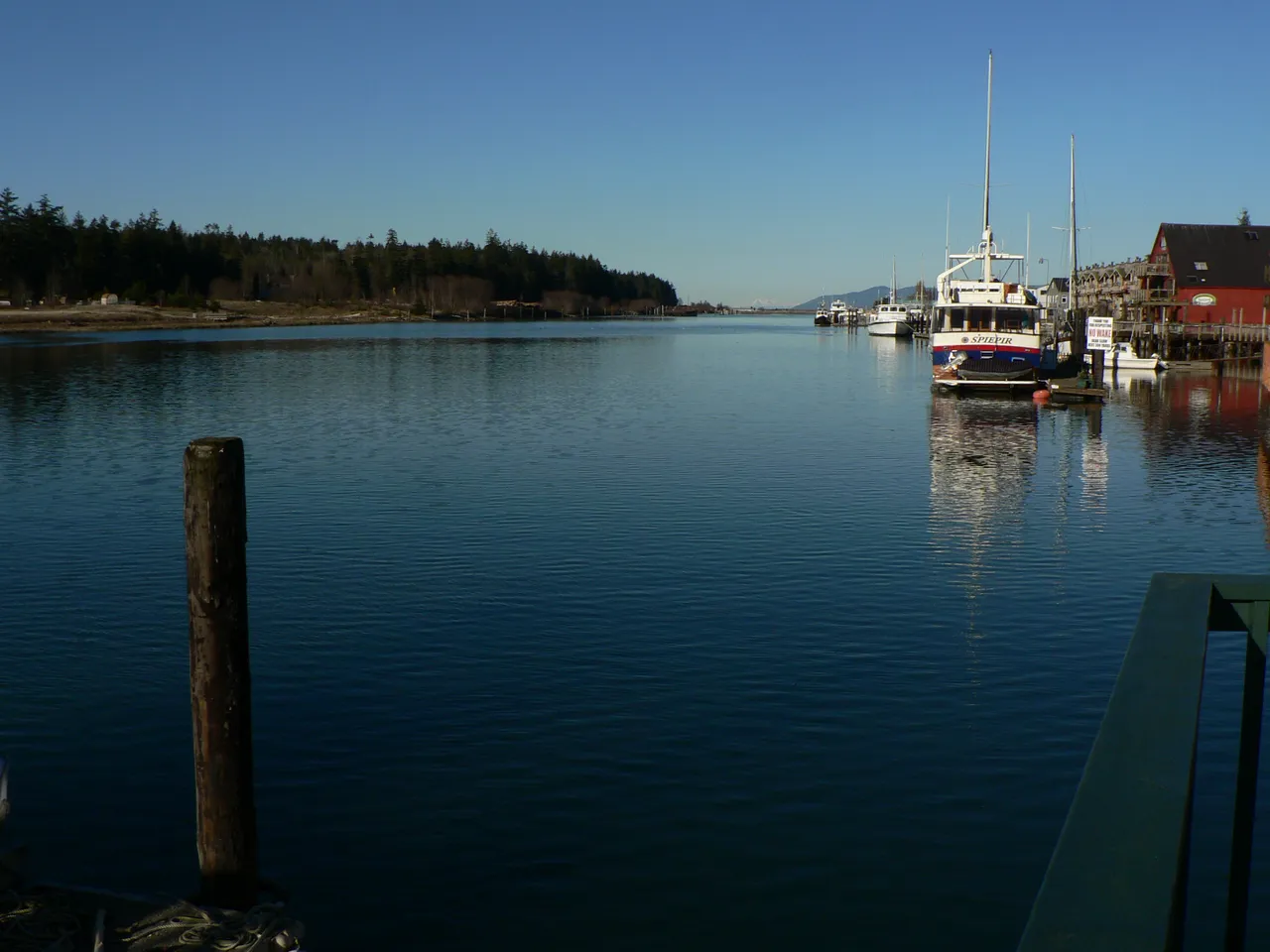
Swinomish Channel is a dredged waterway that joins Skagit Bay and Padilla Bay, running past the town of La Conner. Many boats headed between Seattle and Bellingham take it instead of Deception Pass because the water stays calm and the run is shorter. The trade-off is depth: the channel is kept shallow and can shoal between dredgings.
Depth
Controlling depth about 12 ft below low water (survey 2025-02). Check the tide height and add it to the charted depth before you go through.
Here is what the U.S. Coast Pilot says about Swinomish Channel and the water around it. The official text is below.
Read the official text
Skagit Bay to Bay View
Velocity and direction of the current vary throughout this channel. The flood current enters through Deception Pass and sets in a generally south direction. The ebb flows in a general north direction. Southwest of Hope Island, the velocity is 2.3 knots on the flood and 2.0 knots on the ebb. South of Goat Island the velocity is 1.8 knots on the flood and 1.4 knots on the ebb. North of Rocky Point the velocity is 0.6 knot on the flood and 1.0 knot on the ebb. See the Tidal Current prediction service at tidesandcurrents.noaa.gov for specific information about times, directions, and velocities of the current at numerous locations throughout the area. Links to a user guide for this service can be found in chapter 1 of this book.he Tidal Current Tables for predictions.
Swinomish Channel is a dredged channel that connects Skagit Bay and Padilla Bay. The entrance channel from Skagit Bay leads east-northeast between two jetties and north of Goat Island, thence through Hole in the Wall, at the south part of Fidalgo Island, and north to Padilla Bay. Goat Island is rocky, steep and timber covered. The south jetty, submerged except for a small section near Goat Island, extends about 0.6 mile west of the island and is marked by buoys. The north jetty, submerged and marked by a light off its west end, extends west about 1.1 miles from the south end of Fidalgo Island. The channel is marked with lights, daybeacons and lighted and unlighted buoys. A 251.9° lighted range is on the Skagit Bay side.
Several bridges and overhead power/telephone cables cross Swinomish Channel—minimum clearance of the cables is 72 feet. At the Padilla Bay entrance, the railroad swing bridge has a vertical clearance of 8 feet. The span is left in the open position until a train approaches. Twin fixed highway bridges 0.2 mile south of the swing bridge have a vertical clearance of 75 feet. Just south of La Conner, the highway fixed bridge has a vetical clearance of 75 feet for a center width of 275 feet.
Most of the yachts going between Bellingham and Seattle prefer Swinomish Channel to Deception Pass because of the calmer water and shorter run. The channel is used extensively for towing logs. Two floats and a launching ramp are under the east end of the highway bridge at the north end of Swinomish Channel.
La Conner, near the south end of Swinomish Channel, is the center of a rich agricultural district and has several fish canneries. Many commercial fishing boats operate from here. Piers, wharves and mooring floats are along the entire waterfront, much of which is bulkheaded. A marina at La Conner operates a south and north basin along the east side of the channel about 0.6 and 0.8 mile north of the highway fixed bridge, respectively. The marina has 500 covered and uncovered berths, including about 60 transient berths, and can also provide dry storage. Services available include electricity, gasoline, diesel fuel, water, ice, pump-out facility, launching ramp, marine supplies and an 82-ton marine lift, and complete repairs (hull, engine, electrical) can be made. An extensive log storage and sorting yard is on the west side of the channel opposite the marina basins.
Source: U.S. Coast Pilot 10, Chapter 7, 7 ed. (NOAA,
Office of Coast Survey). Updated weekly. Official Coast Pilot ↗
Local Knowledge
Watch out
After the 2024 to 2025 dredge, the channel was cut back to about 12 feet below low water in most spots. A few places can be shallower. Deeper-draft boats should check the tide height before going through.
Tip
Fixed highway bridges near La Conner and the north end give about 75 feet of clearance. A railroad swing bridge at the Padilla Bay end sits at 8 feet when closed and opens for boats. Overhead cables clear about 72 feet.
Times are NOAA predictions, not live readings. Open a station for its full tide and current charts.
Questions
What is Swinomish Channel?
Swinomish Channel is a dredged waterway that joins Skagit Bay and Padilla Bay, running past the town of La Conner. Many boats headed between Seattle and Bellingham take it instead of Deception Pass because the water stays calm and the run is shorter. The trade-off is depth: the channel is kept shallow and can shoal between dredgings.
How deep is Swinomish Channel?
The controlling depth is about 12 feet below low water (survey 2025-02). Check the tide height and add it to the charted depth before you go through.
What should I watch out for at Swinomish Channel?
After the 2024 to 2025 dredge, the channel was cut back to about 12 feet below low water in most spots. A few places can be shallower. Deeper-draft boats should check the tide height before going through.
What does Class 2 mean?
Class 2 is BoatRoutes' own 1-to-5 rating of how costly a timing or judgment mistake is here — it is not a NOAA scale. Class 2 means one thing to plan around (depth, a schedule, or mild current); getting it wrong costs time, not safety.
Predictions, not observations · U.S. Coast Pilot 10 (7 ed.)
U.S. Coast Pilot text is a work of the U.S. Government and is in the public
domain. Per 17 U.S.C. §403, no copyright is claimed in that text. BoatRoutes
is not endorsed by NOAA.
We use cookies to understand how you use BoatRoutes and improve your experience.
Privacy Policy