Deception Pass is the two-mile gap between Whidbey Island and Fidalgo Island. It links the north end of Skagit Bay with the south end of Rosario Strait. Pass Island pinches the narrowest point to about 150 yards, and a highway bridge crosses overhead with roughly 144 feet of clearance in the middle. The current runs hard here, so most boats time their run for slack water.
Timing
Aim to be in the narrows within about half an hour of slack. Outside that window the current can be too strong for a slower boat to make headway. Fast boats sometimes run it at other stages, but that takes local knowledge.
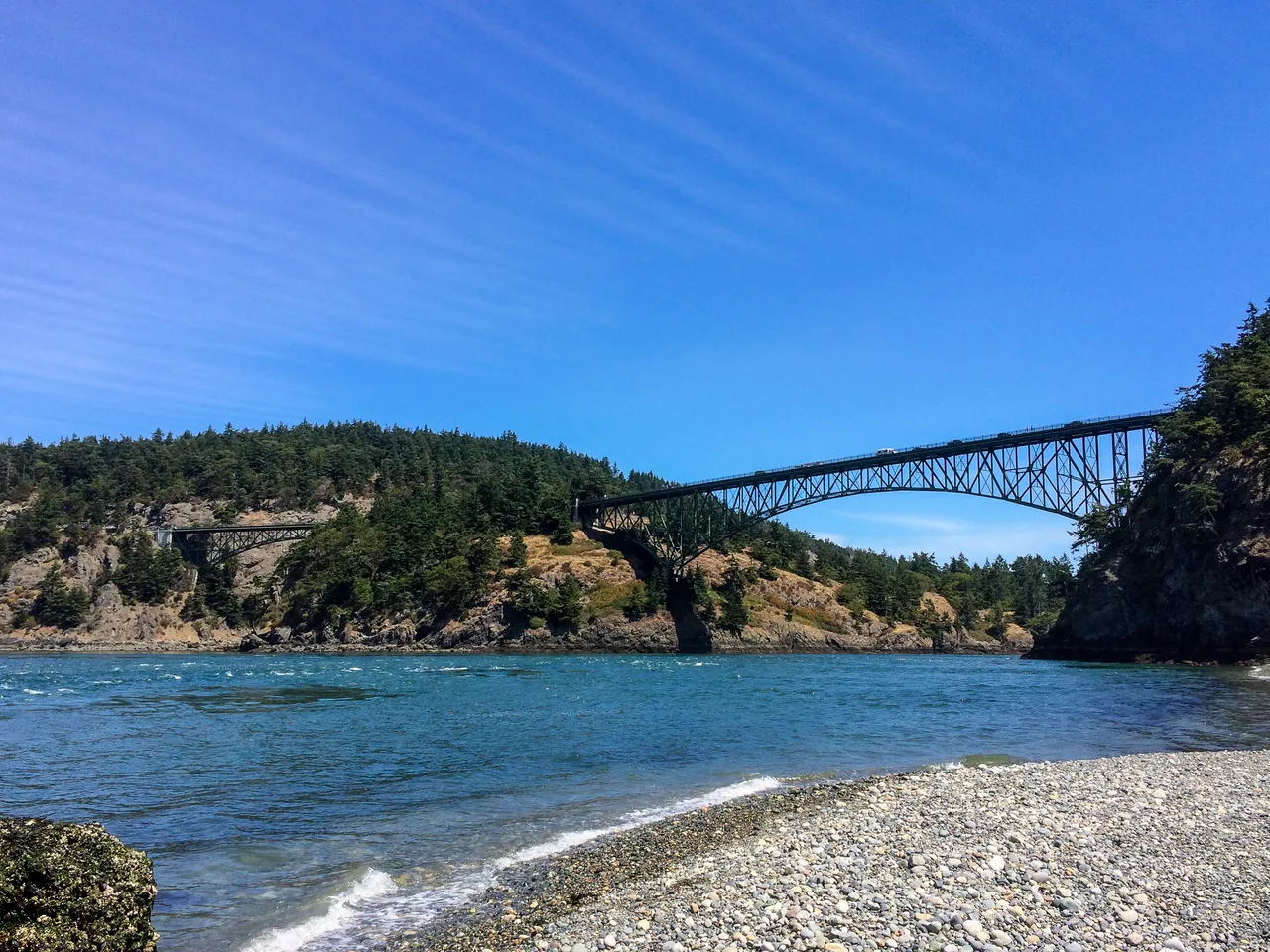
Here is what the U.S. Coast Pilot says about Deception Pass and the water around it. The official text is below.
Read the official text
Deception Pass to Flounder Bay
Deception Pass, the impressive 2-mile passage between Whidbey Island and Fidalgo Island, provides a challenging route that connects the north end of Skagit Bay with the south end of Rosario Strait. Near the middle of the pass, the width is reduced to 150 yards by Pass Island. A fixed highway bridge over the pass between Pass Island and Whidbey Island has a clearance of 144 feet at the center and 104 feet elsewhere. Overhead telephone and power cables 50 yards and 0.2 mile east of the bridge have clearances of 150 feet and 220 feet, respectively.
Deception Pass is used frequently by local boats bound from Seattle to Anacortes, Bellingham and the San Juan Islands. The pass should be negotiated at the time of slack, since the velocity of the stream at other times makes it prohibitive to some craft; however, many fast boats run it at all stages of the tide. The pass is also used by log tows from the north bound to Everett or Seattle, which prefer this route to avoid the rough weather west of Whidbey Island.
Currents in the narrows of Deception Pass attain velocities in excess of 8 knots at times and cause strong eddies along the shores. With west weather, heavy swells and tide rips form and make passage dangerous to all small craft. See the Tidal Current prediction service at tidesandcurrents.noaa.gov for specific information about times, directions, and velocities of the current at numerous locations throughout the area. Links to a user guide for this service can be found in chapter 1 of this book.
Canoe Pass, north of Pass Island, is not recommended except for small craft with local knowledge.
Deception Island, 1 mile west of Pass Island, is 0.4 mile northwest of West Point, the northwest end of Whidbey Island. A shoal that bares at low water extends 175 yards (160 meters) south of Deception Island. Foul ground extends 262 yards (240 meters) northwest of West Point. The passage between these two hazards is 200 yards (183 meters) wide with a least depth of 2.5 fathoms and great care should be taken when navigating in this area. Northwest Pass, north of Deception Island, is the preferred route. The Northwest Pass channel is deeper but narrows and follows close to Lighthouse Point; a light is on the point.
Strawberry Island lies almost in the middle of Deception Pass, 0.4 mile east of Pass Island. Ben Ure Island is 0.2 mile south of Strawberry Island at the entrance to Cornet Bay; a light is at the northeast end of the island.
Cornet Bay, shallow and suitable for small craft only, indents the north end of Whidbey Island, in Deception Pass. A marina with a privately dredged entrance channel and mooring basin is in the bay; the channel is marked by private lights and daybeacons. The marina has about 85 open and covered berths at the floats and can provide gasoline, diesel fuel, electricity, water, ice and marine supplies. A marine service and repair facility is west of the marina. Deception Island State Park is east of the marina and has moorage floats, pumpout facility and launching ramps.
Routes
From west the best water through Deception Pass will be found 0.3 mile west of Rosario Head, a point 0.5 mile north of Deception Island. Steer a southeast course to pass about 100 yards southwest of the light on Lighthouse Point; then follow an east course through the middle of the pass, being careful to guard against sets from the current when running partly across it. After passing under the bridge, favor slightly the north shore so as to avoid the pinnacle rocks and ledges making out from the south shore. After leaving Pass Island, steer to pass about midway between Ben Ure and Strawberry Island. Strawberry Island should not be approached within 125 yards because of a reef, marked by kelp, south of the island. From a position off Ben Ure Island Light 2, steer a northeast course to pass about midway between Hoypus Point and Yokeko Point. The flood current north and west of Strawberry Island sets northeast and should be guarded against.
Bowman (Reservation) Bay, a small bight between Reservation Head and Rosario Head, offers anchorage for small craft in 2¼ fathoms, mud bottom. Northwest Island, between Rosario Head and Sares Head, is 28 feet high and grass-covered. Sares Head, 1 mile north of Deception Island, is steep-to and 480 feet high.
Burrows Bay indents the west shore of Fidalgo Island between Biz Point and Fidalgo Head. Burrows Bay is a broad open bight affording anchorage in the north part, in 15 to 16 fathoms, soft bottom. Protection from west and north is afforded by Burrows Island and Allan Island, but the bay is exposed to south weather. In the southeast part, the depths are less than 6 fathoms, and in places shoals extend almost 0.4 mile off the east and south shores of the bay. East of the passage between Allan and Burrows Islands is a middle ground with a least depth of 5 fathoms. Small craft using Deception Pass, bound to or from points in the islands or from Bellingham Bay, pass through Burrows Bay and the passage north of Burrows Island.
Burrows Island Light (48°28'41"N., 122°42'49"W.), 57 feet above the water, is shown from a 34-foot white square tower on a building at the west end of the island; a mariner-radio-activated sound signal at the station is initiated by keying the microphone five times on VHF-FM channel 83A.
Source: U.S. Coast Pilot 10, Chapter 7, 7 ed. (NOAA,
Office of Coast Survey). Updated weekly. Official Coast Pilot ↗
Local Knowledge
Watch out
The current tops 8 knots at times and throws strong eddies along the shore. When the wind blows from the west, swells and tide rips build and make the run rough for small boats. Rocks and reefs sit close to the channel near Strawberry Island.
Timing
Aim to be in the narrows within about half an hour of slack. Outside that window the current can be too strong for a slower boat to make headway. Fast boats sometimes run it at other stages, but that takes local knowledge.
Tip
Canoe Pass is the small channel north of Pass Island. It is only for small boats whose crews know the area. Take the main channel instead.
Plan a Trip Through Deception Pass
1. Start from
Nearest harbor on each side of the narrows. Pick a side to start there.
2. Cross to the other side of Deception Pass
Oak Harbor Marina → Deception Pass · 10.0 nm · ~1h 15m at · from the south
Times are NOAA predictions, not live readings. Open a station for its full tide and current charts.
Questions
What is Deception Pass?
Deception Pass is the two-mile gap between Whidbey Island and Fidalgo Island. It links the north end of Skagit Bay with the south end of Rosario Strait. Pass Island pinches the narrowest point to about 150 yards, and a highway bridge crosses overhead with roughly 144 feet of clearance in the middle. The current runs hard here, so most boats time their run for slack water.
When is the best time to go through Deception Pass?
Aim to be in the narrows within about half an hour of slack. Outside that window the current can be too strong for a slower boat to make headway. Fast boats sometimes run it at other stages, but that takes local knowledge.
What should I watch out for at Deception Pass?
The current tops 8 knots at times and throws strong eddies along the shore. When the wind blows from the west, swells and tide rips build and make the run rough for small boats. Rocks and reefs sit close to the channel near Strawberry Island.
What does Class 5 mean?
Class 5 is BoatRoutes' own 1-to-5 rating of how costly a timing or judgment mistake is here — it is not a NOAA scale. Class 5 means severe current in a narrow throat — most boats must cross at or near slack; a mistimed run is dangerous.
Predictions, not observations · U.S. Coast Pilot 10 (7 ed.)
U.S. Coast Pilot text is a work of the U.S. Government and is in the public
domain. Per 17 U.S.C. §403, no copyright is claimed in that text. BoatRoutes
is not endorsed by NOAA.
We use cookies to understand how you use BoatRoutes and improve your experience.
Privacy Policy