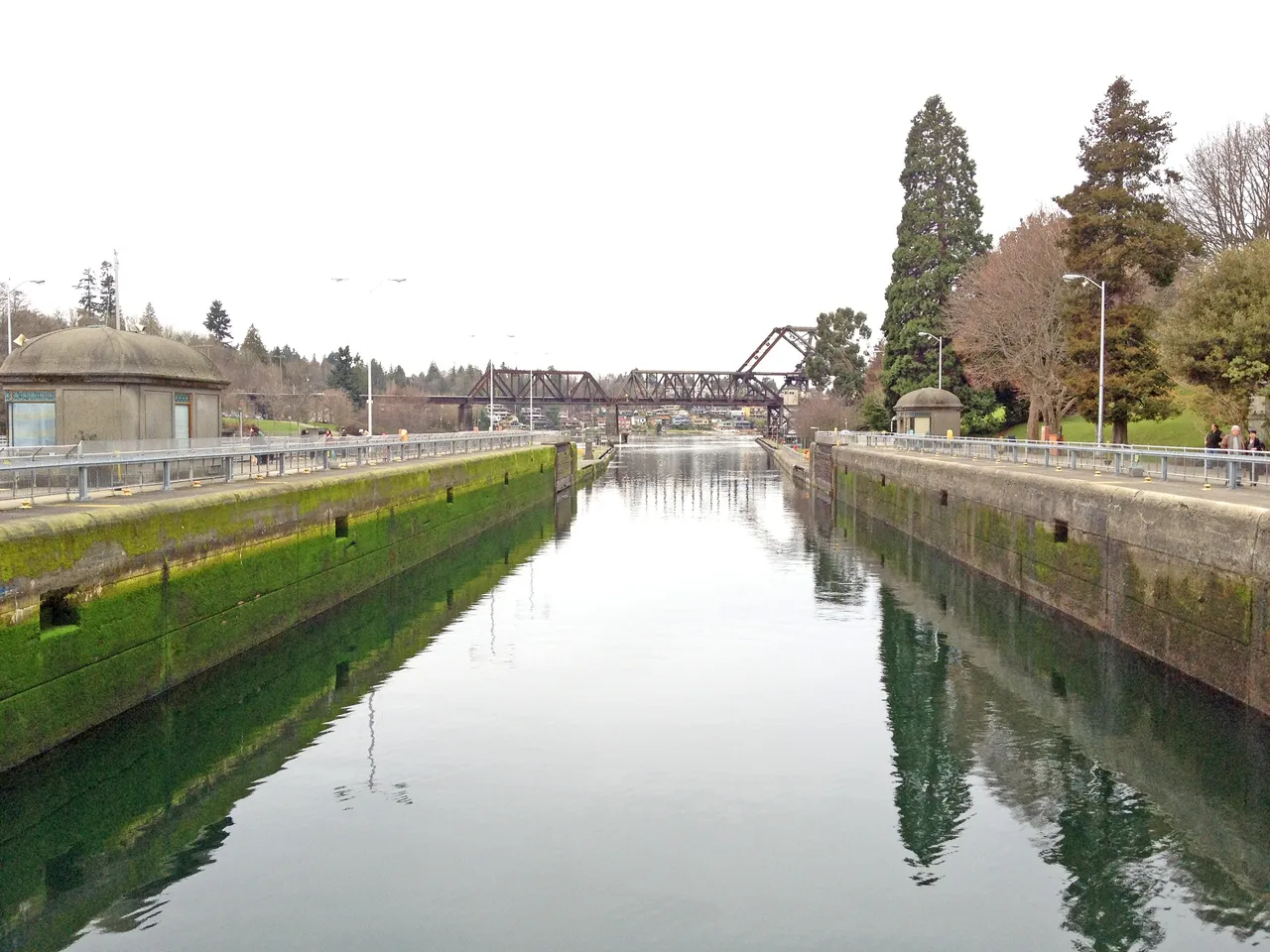
The Ballard Locks are the only route between Puget Sound and Lake Union and Lake Washington. Two locks raise and lower boats about 26 feet between salt water and the fresh water of the ship canal. There is no tidal current above the locks, so timing here is about the lock schedule, not the tide.
How It Works
Boats lock through in turn on the lock tenders' schedule. The large lock is 760 feet long and the small lock is 123 feet. A small boat usually locks through in 5 to 10 minutes once it is its turn. Have your lines and fenders ready before you enter.
Here is what the U.S. Coast Pilot says about Ballard Locks and the water around it. The official text is below.
Read the official text
Lake Washington Ship Canal to Sammamish River
Lake Washington Ship Canal extends from Puget Sound through Shilshole Bay, Salmon Bay, Lake Union, Portage Bay and Union Bay to deep water in Lake Washington. The canal is the only entrance from Puget Sound to Lake Union and Lake Washington and is highly trafficked by recreational boats, fishing vessels and commercial vessels. The entrance to the canal is marked by lighted buoys. The federal project depths in the entrance are 34 feet and 30 feet through the canal. For detailed channel information and minimum depths as reported by the U.S. Army Corps of Engineers (USACE), use NOAA Electronic Navigational Charts. Surveys and channel condition reports are available through the USACE hydrographic survey website listed in Appendix A.
A speed limit of 4 knots is enforced within the guide piers of the Hiram M. Chittenden Locks. A speed limit of 7 knots is enforced elsewhere in the Lake Washington Ship Canal, except in an area marked by four private buoys in the north part of Lake Union.
The Hiram M. Chittenden Locks, a government-owned and -operated double lock, and a fixed dam are at the narrows of the entrance to Salmon Bay, 1.2 miles in from the sound. The large lock, a two-chamber structure, has a clear length of 760 feet, width of 80 feet, lift of 26 feet and depth over the lower miter sill of 29 feet. The small lock has a clear length of 123 feet, width of 28 feet, lift of 26 feet and depth over the lower sill of 16 feet. Passage time is less than 30 minutes for large vessels and 5 to 10 minutes for small vessels. The lock tenders monitor VHF-FM channel 13 and can be contacted at 206–783–7000 for additional information.
A saltwater barrier extends across the east end of the east chamber of the large lock to reduce the intrusion of saltwater into Lake Washington and to conserve water. (See 33 CFR 207.750, chapter 2, for navigation regulations for Lake Washington Ship Canal, the Hiram M. Chittenden Locks and the saltwater barrier.)
Depths
Depths above Hiram M. Chittenden Locks are referred to low water of the lakes, which is 20 feet above the plane of mean lower low water of Puget Sound.
Heights
Vertical clearances above Hiram M. Chittenden Locks are referred to the mean water level of the lakes, which is 21 feet above mean lower low water of Puget Sound.
Salmon Bay extends for about 0.8 mile from the east end of the locks to the Ballard (15th Avenue) Bridge. There are numerous piers and floats with extensive small-craft facilities on the bay. Fishermen’s Terminal, operated by the Port of Seattle, is immediately west of the Ballard Bridge. The terminal is the home port of a large commercial fishing fleet. Depths of 14 to 28 feet are alongside the piers. There are 700 berths for craft 27 to 176 feet long. Complete facilities for fishing boats are available at the 54-acre terminal, including electricity, gasoline, diesel fuel, water, net repair yards and all types of marine supplies. Marine railways at the terminal can handle craft to 300 tons for complete repairs. A travel lift to 46 feet is also available at the terminal.
From Salmon Bay the canal leads southeast to Lake Union, which is about 1 mile long in a north-south direction and about 0.5 mile wide. Depths in the lake range generally from 37 to 41 feet. The lake is heavily utilized by recreational boaters, especially during the summer months. There is a 10-foot shoal about 200 yards offshore from the southwest end of the lake; it is marked by a buoy. Four private buoys in the north part of Lake Union mark an unrestricted speed zone, which is used by boat builders around the lake as a testing area. The buoys are frequently repositioned; caution is advised when transiting the area. Seaplane takeoff and landings are frequent on the east and west sides of the lake. Seasonal buoys (June–September) running the length of the lake show a quick flashing yellow light when seaplanes are present.
Source: U.S. Coast Pilot 10, Chapter 8, 7 ed. (NOAA,
Office of Coast Survey). Updated weekly. Official Coast Pilot ↗
Local Knowledge
Schedule
Boats lock through in turn on the lock tenders' schedule. The large lock is 760 feet long and the small lock is 123 feet. A small boat usually locks through in 5 to 10 minutes once it is its turn. Have your lines and fenders ready before you enter.
Tip
The speed limit is 4 knots inside the lock guide piers and 7 knots elsewhere in the ship canal. The lock tenders keep watch on VHF channel 13 if you need to reach them.
Times are NOAA predictions, not live readings. Open a station for its full tide and current charts.
Questions
What is Ballard Locks?
The Ballard Locks are the only route between Puget Sound and Lake Union and Lake Washington. Two locks raise and lower boats about 26 feet between salt water and the fresh water of the ship canal. There is no tidal current above the locks, so timing here is about the lock schedule, not the tide.
How do I get through Ballard Locks?
Boats lock through in turn on the lock tenders' schedule. The large lock is 760 feet long and the small lock is 123 feet. A small boat usually locks through in 5 to 10 minutes once it is its turn. Have your lines and fenders ready before you enter.
What does Class 2 mean?
Class 2 is BoatRoutes' own 1-to-5 rating of how costly a timing or judgment mistake is here — it is not a NOAA scale. Class 2 means one thing to plan around (depth, a schedule, or mild current); getting it wrong costs time, not safety.
Predictions, not observations · U.S. Coast Pilot 10 (7 ed.)
U.S. Coast Pilot text is a work of the U.S. Government and is in the public
domain. Per 17 U.S.C. §403, no copyright is claimed in that text. BoatRoutes
is not endorsed by NOAA.
We use cookies to understand how you use BoatRoutes and improve your experience.
Privacy Policy