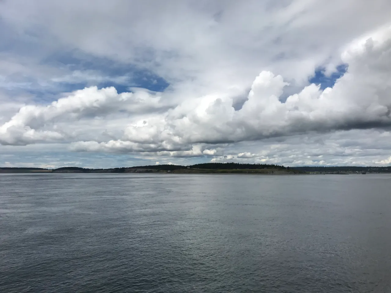
Admiralty Inlet is the main door into Puget Sound. Point Wilson marks the west side and Admiralty Head, on Whidbey Island, marks the east side. Current runs 2 to 7 knots between Point Wilson and Point No Point, one of the stronger stretches on the way in.
Timing
Slack water comes 30 minutes to an hour earlier close to shore than it does out in midchannel, both at Point Wilson and at Marrowstone Point. A boat hugging the beach and one running midchannel won't turn at the same time.
Here is what the U.S. Coast Pilot says about Admiralty Inlet and the water around it. The official text is below.
Read the official text
Dungeness Bay to Partridge Bank
From McCurdy Point, the shore trends east for 3.5 miles to Point Wilson, the west point at the entrance to Admiralty Inlet, and consists of high, bare, clay bluffs, sparsely wooded on top, decreasing in height near McCurdy Point, and ending abruptly close west to Point Wilson.
Point Wilson Light (48°08'39"N., 122°45'17"W.), 51 feet above the water, is shown from a white octagonal tower with a black top on a white building with a red roof, on the east extremity of the low point.
Shoals extend 0.5 mile northwest of Point Wilson to the 5-fathom curve over irregular bottom; these are generally indicated by kelp. The east edge of the shoals rises rather abruptly from deep water. Heavy tide rips extend north of these shoals, being especially heavy with a west wind and ebb current. A lighted buoy marking the shoals is about 0.7 mile northwest of Point Wilson Light.
In approaching Point Wilson in thick or foggy weather, soundings should be taken continuously.
Point Partridge, the Westernmost point of Whidbey Island, has a yellow face and is prominent from the north or south; it is rounding and not easily identified from the west. Point Partridge Light (48°13'29"N., 122°46'10"W.), 105 feet above the water, is shown from a skeleton tower on the west extremity of the point. A rocky ledge, marked by a lighted bell buoy, extends 0.5 mile west from the point. In the summer, the ledge is usually marked by kelp.
The west shore of Whidbey Island, between Admiralty Head and Point Partridge, is mostly a sandy beach rising sharply to bluffs 100 to 250 feet high, backed by pine trees. The shoreline is generally strewn by logs.
Admiralty Head, 80 feet high, on Whidbey Island, is the east entrance point of Admiralty Inlet and the southeast extremity of a succession of light bare bluffs that extend north of Point Partridge, where they attain their highest elevation. About 0.5 mile north of Admiralty Head an abandoned lighthouse tower 39 feet high stands on top of a bluff.
Currents
In Admiralty Inlet and Puget Sound, the tidal currents are subjected to daily inequalities similar to those of the tides. Velocities of 2 to 7 knots occur from Point Wilson to Point No Point. In the more open waters of the sound south of Point No Point the velocities are much less.
Weather (Winds and Visibility), Puget Sound
Poor visibilities are encountered more often north and south of Puget Sound than in the sound itself. In Admiralty Inlet, fog lowers visibilities on this part of the coast to less than 0.5 mile (0.9 km) on about 4 to 8 days per month. South of Point Robinson, in the East Passage, the sound signals operate about 8 to 15 percent of the time in fall and mid-winter. In Puget Sound, sound signals, even during the heart of the season, blow less than 8 percent of the time; less than 5 percent in Elliot Bay. Waters of Point Wells and Three Tree Point are among the most fog free in the area; sound signals there operate just a few hours a month for most of the year. In the Seattle area, visibility falls below 0.5 mile (0.9 km) on about 3 to 6 days per month during the foggy season. Detailed information on heavy weather to Puget Sound ports may be found in the Puget Sound Area Heavy Weather Port Guide published by the Marine Meteorology Division, Naval Research Laboratory, Monterey, CA 93943 and available at nrlmry.navy.mil/pubs.html.
Point Wilson to Kilisut Harbor
Point Wilson is the west point to Admiralty Inlet and Puget Sound.
Point Wilson Light (48°08'39"N., 122°45'17"W.), 51 feet above the water, is shown from a white octagonal tower on a building on the east extremity of the low point.
Shoals extend 0.5 mile northwest of Point Wilson to the 5-fathom curve over irregular bottom; these are generally indicated by kelp. The east edge of the shoals rises rather abruptly from deep water. Heavy tide rips extend north of these shoals, being especially heavy with a west wind and ebb current. A buoy marking the shoals is about 0.7 mile northwest of Point Wilson Light.
In approaching Point Wilson in thick or foggy weather, vessels should obtain soundings constantly.
Fort Worden State Park, formerly an Army base, is about 0.8 mile south-southwest of Point Wilson. The park has 120 feet of dock space and two launching ramps.
Port Townsend, immediately south of Point Wilson, is entered between Point Hudson and Marrowstone Point. It extends in a general south-southwest direction for 2.5 miles and then turns south-southeast for 3 miles, with a reduced width to its head. Inside Point Hudson, depths generally range from 5 to 20 fathoms. It is an excellent harbor and is easily entered; however, mariners are warned to be aware of strong side currents that exist in Admiralty Inlet. The prevailing winds in summer are from west to southwest and in winter are generally in the southeast quadrant.
Midchannel Bank, covered 4¾ to 10 fathoms, extends northwest from Marrowstone Point about 2 miles toward Point Wilson. The bank has several submerged obstructions and large boulders on the bottom. Due to the nature of the bottom and the existence of cross-currents from Admiralty Inlet, the bank is unsuitable for safe anchorage.
Puget Sound
Vessel Traffic Service Puget Sound, operated by the U.S. Coast Guard, has been established in the waters of the Strait of Juan de Fuca, Rosario Strait, Admiralty Inlet, Puget Sound and the navigable waters adjacent to these areas. (See 33 CFR 161.1 through 161.23 and 161.55, chapter 2, for regulations, and the beginning of chapter 7 for additional information.)
Source: U.S. Coast Pilot 10, Chapter 7, 7 ed. (NOAA,
Office of Coast Survey). Updated weekly. Official Coast Pilot ↗
Local Knowledge
Watch out
Shoals reach northwest from Point Wilson, usually marked by kelp, with a lighted buoy off the edge. Tide rips build here, and they get worse with a west wind pushing against an ebb current.
Timing
Slack water comes 30 minutes to an hour earlier close to shore than it does out in midchannel, both at Point Wilson and at Marrowstone Point. A boat hugging the beach and one running midchannel won't turn at the same time.
Tip
Midchannel Bank sits between Point Wilson and Marrowstone Point, covered by 5 to 10 fathoms of water. It has boulders and cross-currents from the inlet, so it's not a spot to anchor even though the chart shows open water.
Plan a Trip Through Admiralty Inlet
1. Start from
Nearest harbor on each side of the narrows. Pick a side to start there.
2. Cross to the other side of Admiralty Inlet
Port Townsend Boat Haven → Admiralty Inlet · 4.5 nm · ~0h 34m at · from the south
Times are NOAA predictions, not live readings. Open a station for its full tide and current charts.
Questions
What is Admiralty Inlet?
Admiralty Inlet is the main door into Puget Sound. Point Wilson marks the west side and Admiralty Head, on Whidbey Island, marks the east side. Current runs 2 to 7 knots between Point Wilson and Point No Point, one of the stronger stretches on the way in.
When is the best time to go through Admiralty Inlet?
Slack water comes 30 minutes to an hour earlier close to shore than it does out in midchannel, both at Point Wilson and at Marrowstone Point. A boat hugging the beach and one running midchannel won't turn at the same time.
What should I watch out for at Admiralty Inlet?
Shoals reach northwest from Point Wilson, usually marked by kelp, with a lighted buoy off the edge. Tide rips build here, and they get worse with a west wind pushing against an ebb current.
What does Class 3 mean?
Class 3 is BoatRoutes' own 1-to-5 rating of how costly a timing or judgment mistake is here — it is not a NOAA scale. Class 3 means real current or confined water — cross near slack or a fair stage; a mistimed run demands attention.
Predictions, not observations · U.S. Coast Pilot 10 (7 ed.)
U.S. Coast Pilot text is a work of the U.S. Government and is in the public
domain. Per 17 U.S.C. §403, no copyright is claimed in that text. BoatRoutes
is not endorsed by NOAA.
We use cookies to understand how you use BoatRoutes and improve your experience.
Privacy Policy